Frigid tonight, another chance for some wintry weather Friday
KNOXVILLE, Tenn. (WVLT) - Temperatures are cooling even more as we head into the overnight hours as we see clear skies and the snow pack still on the ground. The big concern heading into Wednesday morning will be the refreeze as we see temperatures into the single digits and slushy roads icing back over.
Join us on the WVLT First Alert Weather app for iPhone[1] or Android[2], so you can stay informed on the go and in between newscasts. We share custom videos, plus you can choose to get messages from us on the latest conditions and forecasts.
WHAT TO EXPECT
Our coldest temperatures in over a year arrive tonight as we see lows dropping into the single digits for many to start Wednesday morning.
Wind chills will also be a concern as we see southwest winds at 5 to 10 mph making it feel like zero or below at times.
You'll want to keep the kids and yourself bundled up if you plan on heading out the door to play in the snow. Highs will be about the same in the middle 20s once again, but we'll see even more sunshine, which will help to get the roads in better conditions as crews continue to treat them. Some good news is that we are heading back above the freezing mark for Thursday afternoon.
LOOKING AHEAD
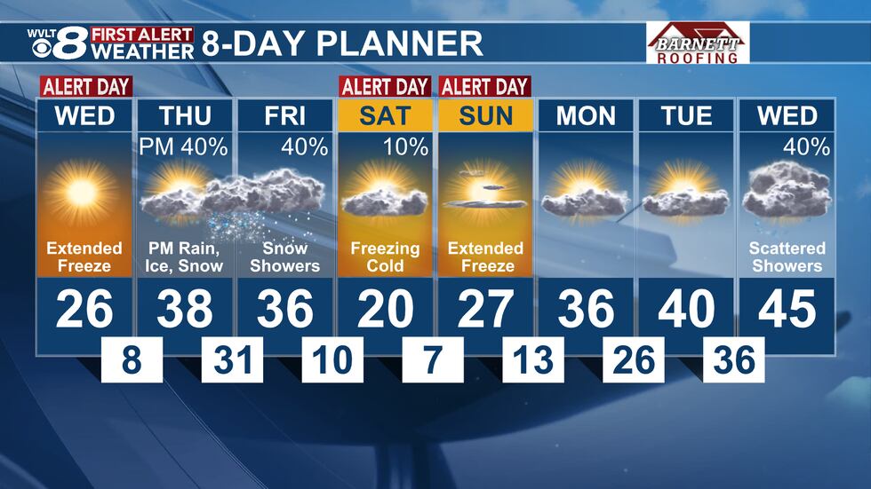
We're keeping a close watch on Thursday night into Friday as temperatures will be marginal enough to potential support some ice or snow for parts of East Tennessee.
It's still too early to tell the exact specifics, but this could linger into the weekend as another blast of cold air arrives.
In you WVLT First Alert 8-Day Planner we're tracking the latest as we continue to see a deep freeze.
 Temperatures quickly fall through the overnight(WVLT)
Copyright 2024 WVLT.
All rights reserved.