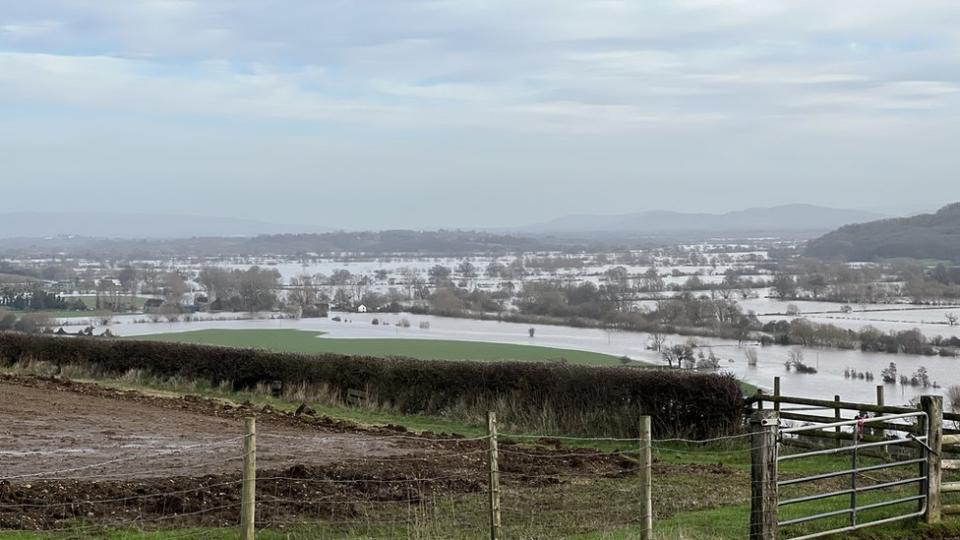
Tewkesbury surrounded by flood water after heavy rain
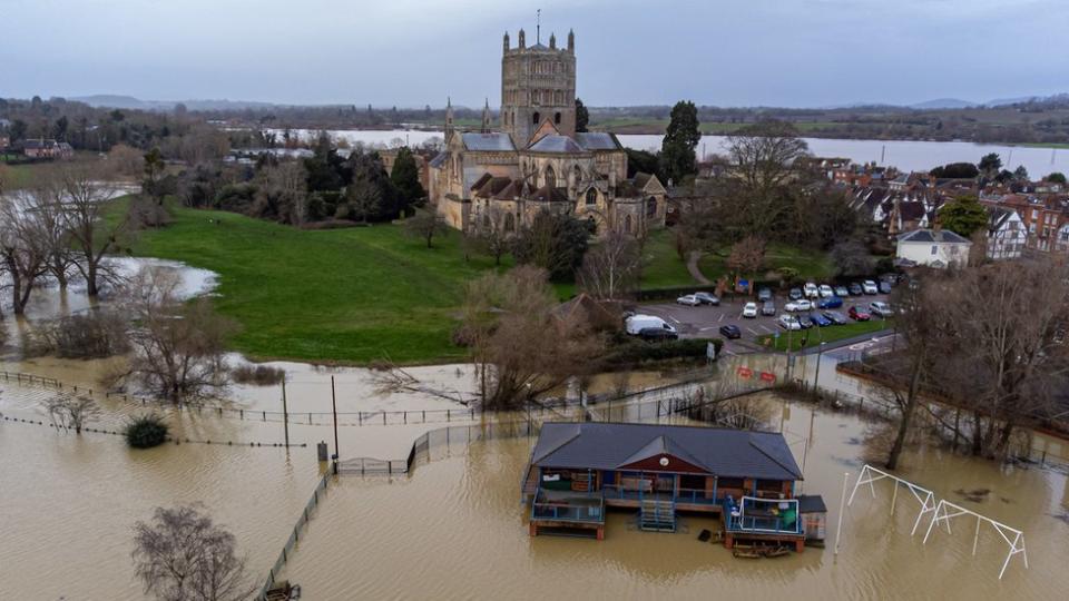
The Environment Agency has warned of flooding of properties and roads around Tewkesbury Residents are being evacuated from their homes as flood waters are close to breaching defences, says a council. Gloucester City Council has advised residents of Alney Island, an island on the River Severn in Gloucester, to go to GL1 Leisure Centre by 22:00 GMT.
The council said flood defences are “close to overtopping”, with water levels expected to peak on Friday. A flood warning is in place, with people asked to move possessions and valuables off the ground. Alney Island is a strip of land sitting between two channels of the River Severn, measuring 2.1 miles (3.3km) long and 0.7m (1.1km) wide and is managed by the city council as a nature reserve which is open to the public.
A number of people live on the island which has a mobile and static caravan park, as well as three streets with houses dating as far back as the 1820s. Flood water is predicted to peak at 4.6m to 4.7m at Gloucester on Friday morning.
Town surrounded
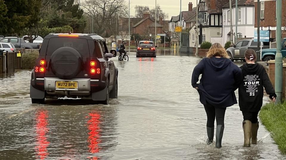
Meanwhile, Tewkesbury is surrounded by flood water, with several roads closed and an evacuation rest centre set up. Nine flood alerts have been issued for the town, involving the River Avon and the River Severn.
Tewkesbury Borough Council has told people who need to evacuate to go to a rest centre at Wheatpieces Community Centre in Walton Cardiff. Of the 23 roads closed by flooding in the county, 10 are in or around the town. Routes into Tewkesbury such as Mythe Road, Ashchurch Road and Gloucester Road are all closed according to Gloucestershire County Council.
The council told people to call 999 and ask for the fire service if they needed to be evacuated. In Wiltshire, flood waters were threatening to reach homes in Bradford-on-Avon, and Melksham Town Football Club shared a photo of their pitch under several inches of water. Wiltshire Police added that it is receiving a high number of calls regarding flooding.
Police advised residents to only travel if they needed to. “If you find a flooded road and you are not stuck then please contact the council,” the police added. Story continues
The crew from Severn Area Rescue Association in Tewkesbury are assisting police, fire and rescue services in the area. The water unit from Gloucestershire Fire and Rescue Service said it had rescued a number of people from flooding in the village of Tirley, south west of Tewkesbury. The service has also warned people not to try and drive through flood water, after it had to rescue a driver.
Don’t drive through flood or tidal water – it’s not worth the risk?? Due to recent weather warnings flooding is more likely to occur? Thankfully, this driver was lucky and came out with no injuries, but that’s not always the case.
Always call 999 if in immediate danger. pic.twitter.com/SH51Sa3XDX[1] — Gloucestershire Fire and Rescue Service (@Glosfire) January 4, 2024[2] Meanwhile, Great Western Railway (GWR) and Network Rail are also advising people not to travel.
Network Rail said key sites, including Westbury in Wiltshire and Taunton in Somerset, were at risk of flooding. The line between Swindon and Bristol Parkway has already closed and trains are being diverted via Bath or Temple Meads, with concerns about other areas too.
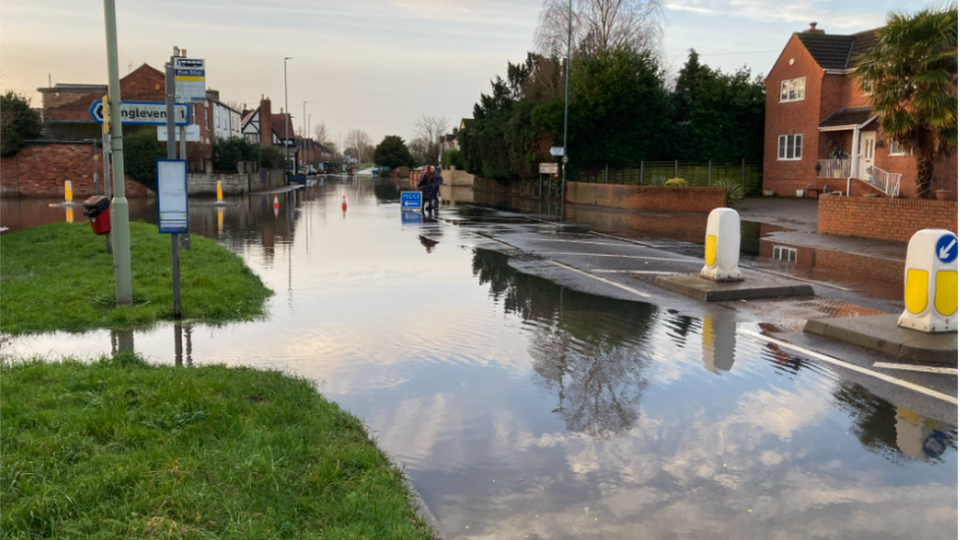
More than 30 flood warnings are in place across Gloucestershire, as well as 27 flood alerts. Meanwhile, there are 12 flood warnings and 30 flood alerts in and around Wiltshire. Flood water has made many roads impassable.
Drivers and pedestrians are being warned not to ignore the closures. “The travelling public should be extremely careful,” said Gloucestershire Highways spokesperson Paul Helbrow. “A number of key routes particularly around the Tewkesbury area have been affected due to rising river levels and other water course levels.
“The current road closures have been introduced for the safety of road users so we urge everyone not to pass our closures, or attempt to drive or walk through flood water,” he said.
Resident Nick Gough, who lives in Longford, fears it will get worse before it gets better: “Two hours ago it was just a puddle, then all of a sudden it [flood water] just came. “The fields have gone, they’re full of concrete now so they’re not soaking up the water so it’s got to go somewhere.
“Water will always find the lowest ground – this is called Longford for a reason.”
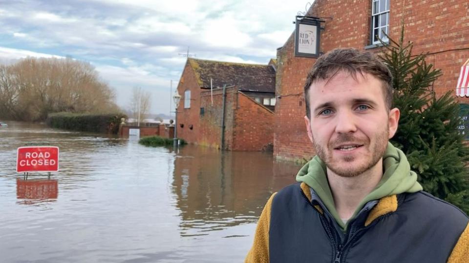
Andrew Taylor, who runs the The Red Lion pub at Wainlode near Gloucester, said: “It leaves you feeling frustrated and helpless. “With older buildings like our pub, it’s inevitable that the water comes in. We are just trying to keep it at bay.
“It’s the worst that the village and locals have seen it since the Tewksbury 2007 floods.[3]“
-
A417, Maisemore
-
A38, Longford, Gloucester
-
A38, Norton, between Tewkesbury and Gloucester
-
B4213, Haw Bridge
-
Ham Road, Haw Bridge
-
Town Street, Haw Bridge
-
Wainlode Lane, Haw Bridge
-
Chaceley’s Rock Street, Haw Bridge
-
Ashchurch Road, Tewkesbury
-
Gloucester Road, Tewksbury
-
Bredon Road, Tewkesbury
-
Walton Cardiff Lane, Tewkesbury
-
Howells Road, Tewkesbury
-
Swilgate Road, Tewkesbury
-
Northway Lane, Tewkesbury
-
Gander Lane, Tewkesbury
-
St Mary’s Road, Tewkesbury
-
Sandhurst Lane, Gloucester
-
B4058, Near Nailsworth, Pyke Quarry
-
B4234 Ross Road, Lower Lydbrook by the Wye, Forest of Dean
-
Bristol Road, Cirencester
-
A417, Driffield Northbound exit, Cirencester
-
A419, Cirencester
-
B3106, Staverton, Wiltshire
-
B3105, Staverton, Wiltshire
-
Cuts Road, East Lyng, Somerset
-
Cheats Road, Ruishton, Somerset
-
New Road, North Curry, Somerset
Follow BBC West on Facebook, X and Instagram.
Send your story ideas to: [email protected][4][5][6]
References
- ^ pic.twitter.com/SH51Sa3XDX (t.co)
- ^ January 4, 2024 (twitter.com)
- ^ since the Tewksbury 2007 floods. (www.bbc.co.uk)
- ^ Facebook (www.facebook.com)
- ^ Instagram (www.instagram.com)
- ^ [email protected] (au.news.yahoo.com)